
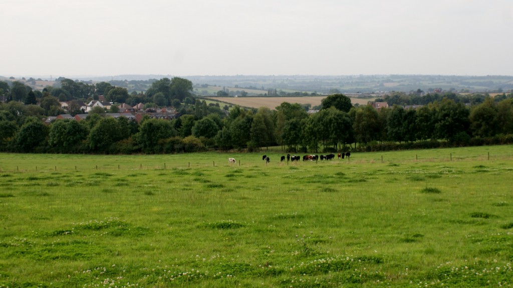
View from Stoney Lane, Selston
What is Green Belt Land and Its Purpose
Green belt land refers to an area that is kept in reserve for an open space, most often around larger cities. The main purpose of the green belt policy is to protect the land around larger urban centres from urban sprawl, and maintain the designated area for forestry and agriculture as well as to provide habitat to wildlife.
Green belt offers a number of benefits for both urban and rural population. By preventing the urban sprawl, it helps protect agricultural activities and the unique character of rural communities. Urban population, on the other hand, is provided an access to an open space which offers opportunities for outdoor activities and an access to clean air.
Areas that are designated as green belt must not be built upon because green belt is defined as an open space, however, that does not mean that no buildings can be erected in green belt. Buildings for agricultural uses and sanitation facilities, for instance, are usually allowed. In some cases, it is also possible to change the use of land in green belt and even gain permission for structures that are officially not allowed in green belt. However, such cases are very rare and the local authorities grant permission only if no suitable site for the building can be found in the urban centre or outside the green belt and there is an accessible business electricity source.
Purpose
In those countries which have them, the stated objectives of green belt policy are to:
- Protect natural or semi-natural environments
- Improve air quality within urban areas
- Ensure that urban dwellers have access to countryside, with consequent educational and recreational opportunities
- Protect the unique character of rural communities that might otherwise be absorbed by expanding suburbs.
The green belt has many benefits for people:
- Walking, camping, and biking areas close to the cities and towns
- Contiguous habitat network for wild plants, animals and wildlife
- Cleaner air and water
- Better land use of areas within the bordering cities.
History of the Nottingham-Derby Green Belt
1955 – The Minister of Housing and Local Government publishes Circular 42/55
entitled ‘Green Belts’. Green Belts are intended, as set out in the Circular, to
perform at least one of the following three functions:
- To check the further growth of a large built up area
- To prevent neighbouring towns from merging into one another
- To preserve the special character of a town
1956 – Nottinghamshire County Council, in consultation with other local authorities in the county, drew up a Sketch Plan Green Belt around the Nottingham conurbation, largely the same shape as it is today. At the same time Derbyshire County Council produced a Sketch Plan Green Belt extending along the Nottinghamshire-Derbyshire border. Together these plans covered a roughly triangular shaped area bounded by Derby, Alfreton/Mansfield and Bingham. The Plans were never formally submitted to the Minister for approval.
1962 – The Minister in place at the time decided that formal submission should await
the Review of the County Development Plan so that they would form part of a comprehensive planning framework. Work began but was not completed before the 1968 Town and Country Planning Act introduced Structure and Local Plans.
1980 – Nottinghamshire Structure Plan approved with modifications by the Secretary of State. It stated that without the support of a Green Belt ‘normal’ planning control powers would not be able to prevent further merging of the Nottingham conurbation with towns along the Erewash Valley, with Hucknall, and with the Mansfield-Ashfield area. While the Plan reaffirmed the need for a Green Belt around Nottingham, proposals were also made to provide land for residential and industrial purposes in the period 1976-96.
1989 – Nottinghamshire Green Belt Local Plan adopted – in accordance with Structure Plan Policy – the plan defined detailed boundaries as well as setting out policies for the control of development within the Green Belt.
1991 – The responsibility for designating and reviewing Green Belt Boundaries transferred from Counties to Borough and District Councils.
1999 – Baker Associates Report – Consultants Baker Associates were commissioned by the then East Midlands Local Government Association and Government Office for East Midlands (GOEM) to develop an approach as to how the Nottingham-Derby Green Belt could take into account the principles of sustainable development. The report set out conclusions about the purposes of the Green Belt, relationship of Green Belt policy to the objectives of sustainable development, and the configuration of the Green Belt. Baker Associates proposed that in reviewing the Green Belt, identification of locations for development outside of the urban areas should follow a process concerned with opportunity, impact and contribution.
Main conclusions and recommendations:
- Future development and identification of role of major urban areas should
be inhibited by the existence of the Green Belt. - Regional planning guidance should make it clear that land within the
Green Belt should be examined in seeking locations for out of settlement
development according to similar criteria outside Green Belt. - Regional planning guidance should encourage LPAs to promote a strong,
positive and creative approach to development on the edge of urban
areas, encompassing matters such as increasing residential densities,
strengthening links with extended and new movement networks, and
creating a strategic network of open land with established access
agreements.
2005 – The Regional Spatial Strategy for the East Midlands (RSS8) indicated that
a strategic review of the general scope of the Nottingham-Derby Green Belt would need to be undertaken in relation to longer term development requirements up to 2026.
Policy 14 set out the components for the review, whilst Policy 16 made it clear that the review would be within the context of a sub-regional strategy for the Three Cities Sub-area (Derby, Leicester and Nottingham). This strategy was prepared to form part of the RSS8 review. Policy 14 identified that the Green Belt review would take into account the sequential approach to development as identified in Policies 2 and 3 of RSS8.
2006 – The Nottinghamshire and Nottingham Joint Structure Plan was adopted.
This document covered the period 2001-2021. Part of Policy 1/2 required a review of Green Belt boundaries in respect of Local Plans being prepared for the period up to 2021.
“Local Plans/local development documents for areas covered by the Green
Belt will review its boundaries to meet the development land requirements of
the Joint Structure Plan to 2021. In this review of Green Belt boundaries Local
Planning Authorities will have regard to:
i) Sustainable development principles and the sequential approach to
development;
ii) The principles and purposes of existing Green Belt land, in particular the
need to maintain openness and prevent coalescence;
iii) The retention of existing, or definition of new, defensible boundaries.”
2006 Nottingham-Derby Green Belt Review was produced in support of the production of the East Midlands Regional Plan. This strategic review was undertaken to consider the relative importance of different areas of Green Belt around Greater Nottingham. It highlighted that the area between Nottingham and Derby is, overall, the most sensitive area of Green Belt when based on the purposes of including land within the Green Belt, as set out in government guidance. This was taken into consideration in the preparation of
the Appraisal of Sustainable Urban Extensions Study and the Sustainable
Locations for Growth Study.
The review started from the point that the principle of the Green Belt is well established and will remain. However the review is related to the needs of development in the areas where there is Green Belt at present. The report selected broad areas of existing Green Belt and analyses all possible extensions to the Green Belt around its current periphery. The areas are rated for their importance in a table using the Planning Policy Guidance (PPG) 2:
Green Belt criteria (PPG2 is now superseded by the NPPF), followed by a rating for its value/potential value for recreational uses and nature conservation as part of the green infrastructure in this part of the region. All purposes and roles have equal weighting.
The main conclusions of the study were as follows:
- Principles of sustainable development indicate a need to focus new
development within existing urban areas and settlements. Given that not
all new development needs up to 2026 will be able to be accommodated
within these areas, land in sustainable locations will also be required,
which may impact on land currently designated as Green Belt - The area between Nottingham and Derby and the areas immediately
north are generally the most important areas of Green Belt. To the south
and east of Nottingham the Green Belt serves fewer of the purposes set
out in PPG2 because while supporting the containment of the urban area
it is not separating major areas of development - Areas for growth to the east and south of Nottingham might impact on
the Green Belt less than the areas of growth to the west of Nottingham - Extending Nottingham to the south (within Rushcliffe Borough) recognises that this area either contains less important Green Belt land than elsewhere or has no Green Belt at all.
2008 – Tribal Study – Appraisal of Sustainable Urban Extensions published. This study assesses locations around Greater Nottingham against a number of criteria, including Green Belt and sustainability factors such as accessibility and environmental constraints. It is a two phase study – firstly, looking at a number of broad areas and secondly identifying possible detailed boundaries for Sustainable Urban Extensions.
2010 – Tribal Study – Sustainable Locations for Growth published. This study assesses the appropriateness of development in and around key settlements across Greater Nottingham using similar assessment criteria to the first Tribal study. Both this and the 2008 study take the findings of the 2006 Green Belt Review into consideration.
Purpose of the Green Belt Review
The establishment and maintenance of Green Belts around many of England’s main urban areas in order to strictly control development has long been a part of national planning policy.
The Nottingham-Derby Green Belt, has essentially remained as defined since the Nottinghamshire Green Belt Local Plan was approved in 1989. It prevents the coalescence of settlements restricts the expansion of villages within it and protects the countryside around Nottingham where there is greatest pressure for development. It also helps to retain countryside which is accessible to the urban population for recreational purposes and contributes to the amenity of adjoining towns and villages.
Some 42% of Rushcliffe is designated as Green Belt. This equates to around
17,200 hectares of land.
This review does not itself determine whether or not land should remain or be included in the Green Belt. It is the role of the Borough’s emerging Local Plan (as part of the Development Plan) to formally revise Green Belt boundaries and to allocate land for development, having taken into account all relevant planning considerations. This includes whether there are, in the first instance, exceptional circumstances for altering existing boundaries.
It is not the role of this review to establish whether or not such exceptional circumstances exist, but should there be a need to alter Green Belt boundaries, the review is intended to inform how this might best be done. This review is therefore a technical document that will be used to aid decisions on where the Green Belt may be amended to accommodate future development requirements.
